
Warner Robins ZIP Coverage
Five ZIPs are clearly associated with Warner Robins in official postal or city sources, but they do not all serve ordinary neighborhood delivery. Three nearby postal areas can also matter at the city's irregular edge. Treat the descriptions as orientation, then verify a real address with USPS and the county parcel map.
| ZIP | Functional area | Postal point | Boundary note |
|---|---|---|---|
| 31088 | Primary south and central delivery area | Warner Robins Post Office, Russell Parkway | Ordinary delivery ZIP |
| 31093 | North and northwest delivery area | Northside Station, North Davis Drive | Ordinary delivery ZIP |
| 31095 | City-government PO box use | Warner Robins postal operation | Mailing and PO-box function |
| 31098 | Robins Air Force Base | Installation postal operation | Institutional ZIP with distinct access |
| 31099 | Special Warner Robins use | Exact facility not established | Not an ordinary neighborhood ZIP |
| 31028 | Centerville and northwest urban area | Centerville | Postal area is not the city limit |
| 31005 | Bonaire and southeast fringe | Bonaire | Check parcel-level overlap |
| 31008 | Byron and west/northwest fringe | Byron | Peach County context may apply |
The USPS facility list supports the two main Warner Robins stations. Official city pages support use of 31095 and 31099, while postal bulletins associate 31098 with the base. Exact fringe overlap for Bonaire and Byron requires an address-level check. A ZIP code directory should not turn a nearby postal area into a claim that every parcel lies inside Warner Robins.
Verify Warner Robins ZIP Addresses
The USPS ZIP Code Lookup standardizes a delivery line. It is the strongest first check for the postal city and ZIP attached to one address. The result does not determine municipal incorporation, deed county, school zone, precinct, or permit authority.
| USPS field | Required? | Input | What it does |
|---|---|---|---|
| Company | No | Organization name | Adds business context |
| Street Address | Yes | House number and road | Identifies delivery point |
| Apt/Suite/Other | No | Unit detail | Distinguishes secondary address |
| City | Yes | Postal city | Pairs place name with address |
| State | Yes | GA | Limits the lookup to Georgia |
| ZIP Code | No | Five digits if known | Helps test or complete the line |
The portal also offers city-and-state and cities-by-ZIP modes. Use those for orientation, not to infer everyone within the result. Warner Robins postal geography is broader and less regular than a single municipal polygon.
Open the official USPS lookup before entering a nonprivate address.
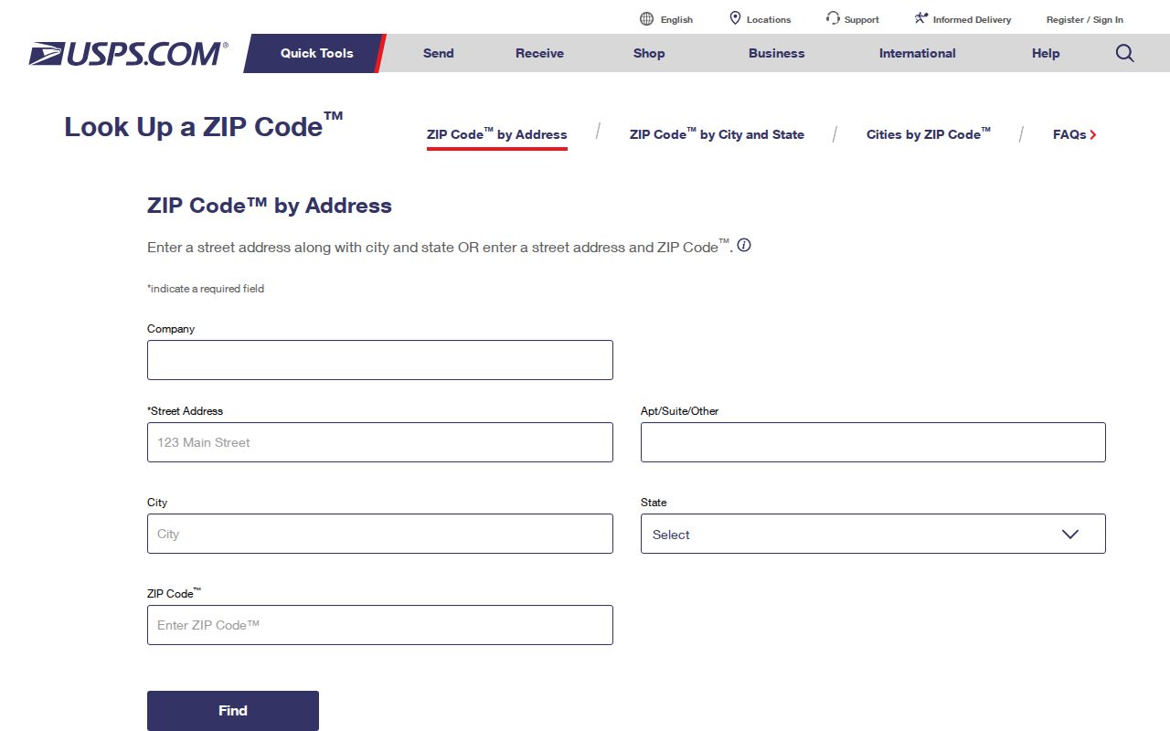
The captured form shows the address fields needed to confirm delivery formatting before county-record research begins.
Warner Robins Postal Terms
Postal terms are easy to overread. A five-digit ZIP groups delivery, while ZIP+4 refines the route to a smaller delivery unit. Neither is a legal boundary. Warner Robins also has codes tied to boxes, city use, and a federal installation, so the code alone cannot be treated as a neighborhood roster.
- ZIP code
- A five-digit Postal Service delivery area, not a city-limit line.
- ZIP+4
- The basic ZIP plus four digits that narrow mail sorting to a smaller delivery unit.
- PO-box ZIP
- A code used mainly for post-office boxes rather than ordinary street delivery.
- Unique ZIP
- A code assigned for a large institution or special mail function.
- Carrier route
- The ordered group of addresses served by one delivery route.
A Census ZIP Code Tabulation Area, or ZCTA, is a statistical approximation. It is useful for population analysis but does not reproduce USPS routes. Likewise, the city's 2025 estimate of 87,761 residents describes the incorporated place, not a sum of its postal codes.
Find Warner Robins Residents by ZIP
A ZIP code directory narrows geography; official records do the identification. The local qPublic landing searches focus on owner, address, parcel, and legal information. Research did not confirm a public ZIP-wide assessor filter or export, so do not promise one. The GIS can show parcels in an area, but only if the relevant layer is actually enabled.
- Run the full address through USPS Lookup. Save the standardized postal city and code.
- Use the Census or city map plus county GIS to establish incorporation and Houston or Peach jurisdiction.
- Search the correct qPublic by situs address. Keep the owner's mailing ZIP separate from the property's physical location.
- Browse mapped parcels only within a stated area. Do not assume every parcel sharing the code lies in Warner Robins.
- Use lawful voter data or dated historical sources only for the role and time each source documents.
- For an existing county digest export with ZIP fields, ask the custodian about availability, format, lawful access, and cost.
Georgia My Voter Page is a self-check that requires personal inputs, not a ZIP browse. State elector files include parsed residence ZIP fields under access and use rules, but protected addresses are withheld. Once a code has been narrowed to a named road, the Warner Robins street directory method gives the address-level parcel and deed workflow.
Separate Warner Robins ZIP Fields
The situs is the assessor's location for the parcel. The owner mailing address is the destination for tax correspondence and may be elsewhere. USPS supplies the standardized delivery line. A deed's legal description identifies the land through subdivision, lot, block, land district, land lot, acreage, or measured boundaries. These fields may point to different ZIPs without conflicting.
For Peach County property, pre-2001 parcel and account numbers differ from current identifiers. Carry the legal description and deed book and page across that change. This practical bridge matters more than a modern ZIP, which may not belong to the period being researched.
Key distinction. A tax-mailing ZIP can locate correspondence, but it does not prove that the owner resides at the Warner Robins parcel.
Warner Robins County-Line ZIPs
The 2024 Census Boundary and Annexation Survey map confirms that Warner Robins crosses Houston and Peach counties. The municipal edge is highly irregular and does not match a postal polygon. A west-side search may cross a county line and a postal-name line without the street ending. That quirk changes the assessor, deed clerk, and tax office while the surrounding urban landscape looks continuous.
Check each parcel rather than assigning all of 31008, 31028, or 31005 to the city. Centerville, Byron, and Bonaire postal labels have their own delivery logic. The county map and parcel viewer decide records jurisdiction; USPS decides the delivery line.
Note: A Warner Robins ZIP can orient a search, but only a mapped parcel can settle the county that holds its deed and assessment.
Warner Robins Annexation Traps
Annexation can change city services, zoning, and the custodian of permit or code files. It normally does not move land between Houston and Peach counties, and it does not prove that USPS changed the ZIP. Search the annexation ordinance and effective date through Warner Robins Planning and Zoning or city records.
A renamed road, new directional tag, highway alias, or changed house number can also break an address-only search. No authoritative citywide renumbering date was found. Bridge the current situs to the parcel ID, legal description, deed and plat, historical tax account, then a dated directory or map. Historical residents from before modern ZIP use should be sought through those older geographic keys.
Warner Robins Growth by ZIP
Census QuickFacts reports 80,308 Warner Robins residents in 2020 and an estimated 87,761 in 2025, a 9.2 percent increase from the estimates base. Those figures belong to the incorporated city. They should not be assigned across ZIPs by simple division, because postal zones extend beyond city limits and the special codes do not represent ordinary neighborhoods.
Fast growth also makes old address claims age quickly. New development, annexation, and account changes can alter which office holds a permit or how a parcel is labeled. Date every ZIP code directory result and verify it at the address level before drawing a conclusion about a current resident.
Warner Robins ZIPs Versus Limits
City limits, county lines, and postal codes answer three separate questions. The incorporated boundary establishes municipal jurisdiction. Houston or Peach County controls the parcel, deed, and county tax chain. USPS sets the mail format. One address can carry a neighboring postal city while remaining inside Warner Robins, or carry a Warner Robins label outside the incorporated edge.
Do not use a ZIP as a proxy for a voting district, school zone, utility area, emergency-response district, or permit authority. Each has its own map and custodian. For a clear result, preserve the USPS line, parcel jurisdiction, city-limit status, and source date as four separate fields.
Boundary caution. A ZIP identifies mail delivery, not everyone who lives in it. Use resident information only for lawful personal research and never for harassment.